TOMORROWS TRANSPORTATION NEWS TODAY!

Tag: GPS

Eve announces list of eVTOL suppliers

Melbourne, Florida, January 29, 2024 – Eve Air Mobility (NYSE: EVEX) has named four additional suppliers for its electric vertical takeoff and landing (eVTOL) aircraft. Thales will supply a proven air data solution, comprising sensors and a computer while Honeywell (NYSE: HON) will supply guidance, navigation and external lighting for the aircraft. RECARO Aircraft Seating will supply the eVTOL’s seats and FACC will supply the horizontal and vertical tail including the rudder and elevator.

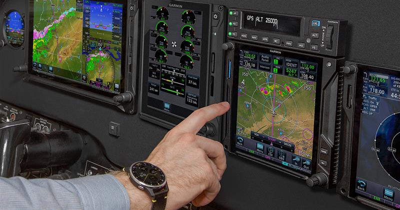
Honeywell will supply guidance and navigation products including magnetometers, GPS-aided attitude & heading reference systems, and inertial reference systems built upon decades of engineering and manufacturing experience. These systems will relay and aid the pilots and other onboard systems to ensure safe and efficient flight.  The company will also supply external lighting for the aircraft.

Thales will supply a proven air data solution, comprising sensors and computer, which gather critical data such as airspeed, altitude and environmental conditions. The solution then relays the information to pilots and onboard systems to ensure safe and efficient flight in all weather conditions.

RECARO Aircraft Seating, a global supplier of premium aircraft seats for airlines, OEMs and eVTOL aircraft, was selected to design, certify and produce the four passenger seats and one pilot seat for the aircraft. RECARO is widely recognized for product innovation, award-winning customer service and commitment to reliability, efficiency and sustainable practices.

FACC was selected to lead the development and production of the eVTOL’s horizontal and vertical tail including its rudder, elevator and the aircraft’s aileron.  FACC is recognized for its production of lightweight components relying on innovative manufacturing techniques and technology.

These new suppliers are in addition to Garmin (NYSE: GRMN), Liebherr Aerospace and Intergalactic that were announced in October and Nidec Aerospace LLC, a joint venture between Japan’s Nidec Corporation and Brazil’s Embraer SA (B3: EMBR3), BAE Systems PLC (London: BAES) and DUC Hélices Propellers which were announced at the Paris Air Show this past summer.

Forward-Looking Statements

This press release may contains forward-looking statements within the meaning of the Private Securities Litigation Reform Act of 1995, including expected delivery dates. Such statements are based on current expectations and projections about our future results, prospects and opportunities and are not guarantees of future performance. Such statements will not be updated unless required by law. Actual results and performance may differ materially from those expressed or forecasted in forward-looking statements due to a number of factors, including those discussed in our filings with the Securities and Exchange Commission.


Copy Translate
Copy Translate

Garmin receives certification for GFC 600 digital autopilot in Beechcraft King Air F90 aircraft

Olathe, Kansas, August 23, 2023 — Garmin (NYSE: GRMN) today announced it has received Federal Aviation Administration (FAA) Supplemental Type Certification (STC) for the GFC 600 digital autopilot in Beechcraft King Air F90 aircraft. The GFC 600 digital autopilot is optimized for turbine aircraft, delivering superior in-flight characteristics that reduce workload and bring new operational capabilities such as Vertical Navigation (VNAV)1, automatic Course Deviation Indicator (CDI) switching when paired with a GTN Series navigator, enhanced go-around capabilities including missed approach sequencing — and much more.

The GFC 600 certification for the King Air F90 provides owners and operators with an autopilot upgrade that boasts superior integration potential with G600 and G600 TXi flight displays, the GI 275 electronic flight instrument, as well as the GTN and GTN Xi Series of navigators. The self-contained autopilot controller incorporates backlit keys and a bright, sunlight readable display that depicts autopilot status and mode selection. An intuitive built-in control wheel also provides convenient adjustment of aircraft pitch, airspeed and vertical speed modes. When the level button is selected, the aircraft automatically returns to straight-and-level flight.

Environmentally hardened autopilot servos designed for harsh operating conditions contain brushless DC motors offering improved performance and reducing maintenance requirements when compared to decades-old servo designs on the market today. In addition, these servos offer more torque to help pilots better respond to demands required of turbine aircraft.

Standard mark-width (6.25-inch) design of the GFC 600 mode controller ensures the autopilot controller allows for routine installation into the aircraft’s avionics stack. In King Air F90 aircraft, GFC 600 will require a G600 TXi or G600 flight display.

In addition to traditional autopilot capabilities such as altitude hold, vertical speed and heading modes, the GFC 600 includes:

  • Premium functions and advanced capabilities such as altitude pre-select2 and indicated airspeed hold mode.
  • Ability to select, couple and fly various instrument approaches, including GPS, ILS, VOR, LOC and back course approaches.3
  • Built-in GPS roll steering capability eliminates the need for external roll steering converters and allows for smoother navigation tracking when installed with a compatible navigator.
  • Level Mode button, which automatically engages the autopilot to restore the aircraft to straight and level flight.
  • Underspeed and overspeed protection.
  • Yaw Damping (YD) mode minimizes yawing oscillations while also helping to maintain coordinated flight.
  • Flight Director command bars can be displayed on a flight display such as the G600 and G600 TXi.
  • Coupled ‘go-arounds’ for pilots to fly during missed approach sequencing. A remotely installed go-around button commands the Flight Director to display the appropriate pitch attitude required for the missed approach procedure and activates a loaded missed approach when paired with a GTN 650/750 or GTN 650Xi/750Xi navigator.
  • Included pitch-trim servo adds automatic trim and improved manual electric trim.
  • Control wheel steering is available, which allows the pilot to adjust pitch, roll, altitude hold, vertical speed or airspeed references using the control yoke while the autopilot is engaged.

Garmin Certifies the GFC 600 Digital Autopilot in Select Pilatus PC-12 Aircraft

Garmin International Inc. (Nasdaq: GRMN), a unit of Garmin Ltd., today announced it has received Federal Aviation Administration Supplemental Type Certificate approval for the GFC 600 digital autopilot in select Pilatus PC-12/41 and PC-12/45 aircraft. The GFC 600 digital autopilot is optimized to meet the demands of turbine aircraft, delivering superior in-flight characteristics and operational capabilities such as Vertical Navigation (VNAV), automatic Course Deviation Indicator (CDI) switching when paired with a GTN Series navigator, enhanced go-around capability and much more.

The GFC 600 certification for the PC-12 boasts superior integration with a TXi flight display configured as a primary flight display (PFD) to provide owners and operators an advanced autopilot solution that considers the wide range of speed and performance characteristics of these turbine aircraft. Further, the GFC 600 incorporates solid-state attitude with robust self-monitoring capabilities to provide superior autopilot performance, greater reliability and renowned safety benefits. Environmentally hardened autopilot servos designed for harsh operating conditions contain brushless DC motors offering improved performance and reducing maintenance requirements when compared to decades-old servo designs on the market today. Standard mark-width (6.25-inch) design of the GFC 600 mode controller ensures the autopilot controller allows for routine installation into the aircraft’s avionics stack.

Going beyond traditional autopilot capabilities such as altitude hold, vertical speed and heading modes, the GFC 600 also includes altitude preselect, VNAV, Level Mode with the LVL button, underspeed and overspeed protection and more. Pilots can also select, couple and fly various instrument approaches, including GPS, ILS, VOR, LOC and back course approaches when paired with a compatible GPS navigator.

Additional benefits of the GFC 600 digital autopilot for turbine aircraft include:

  • Premium functions and advanced capabilities such as altitude pre-select on a TXi flight display configured as a PFD and indicated airspeed hold mode;
  • Built-in GPS roll steering capability eliminates the need for external roll steering converters, allowing for smoother navigation tracking when installed with a compatible navigator;
  • Yaw Damping (YD) mode minimizes yawing oscillations while also helping to maintain coordinated flight;
  • Flight Director command bars displayed on a TXi flight display configured as a primary flight display (PFD);
  • Coupled ‘go-arounds’ during missed approach sequencing with a remotely-installed go-around button that commands the Flight Director to display the appropriate pitch attitude required for the missed approach procedure and activates a loaded missed approach when paired with a 
    GTN 650/750 or GTN 650Xi/750Xi navigator;
  • Control wheel steering allows the pilot to adjust pitch, roll, altitude hold, vertical speed or airspeed references using the control yoke while the autopilot is engaged.

Leading the Way for the Future of EGNOS

Airbus-led consortiums have recently won a series of contracts to shape the future of EGNOS, the European Geostationary Navigation Overlay Service. EGNOS enhances Galileo and GPS signals to provide augmented safety of life services.

EGNOS V3, set to replace the current version, is already being developed by a consortium of 20 European companies led by Airbus. It will enable ‘Category I’ automatic landing of aircraft – with the flight crew supervising – in weather conditions where it would otherwise be dangerous or impossible to operate. 

To prepare EGNOS V3 Evolutions, the European Space Agency (ESA) has awarded a new study contract to Airbus.  The focus is on the use of the augmentation service for stringent operations like Category II approach and landing under very low visibility conditions going beyond the current EGNOS V3 performance requirements.

Preceding this, Airbus has been conducting an innovative study under the ESA NAVISP Programme to assess the potential of sensor fusion techniques, for aviation applications demanding stringent performance requirements aiding operations under low visibility conditions. The study assesses the fit and the benefits of this approach to the Positioning Navigation & Timing (PNT) requirement adherence, in particular for the Satellite Navigation.

In addition, Airbus, together with European partners, has won a series of contracts from the European Global Navigation Satellite Systems Agency (GSA) and ESA to extend EGNOS service use for the safe operations of railways. The resulting projects are:

– CLUG (Certifiable Localisation Unit with GNSS): GNSS could prove a game changer for the European railway network by enabling a significant reduction of trackside equipment and by improving localisation performance. This project is performing mission analysis/needs identification and a preliminary feasibility study of an on-board localisation unit.

– GREET (GNSS for the Railway EnvironmEnT) ESA recently awarded Airbus a study for the development of a railway GNSS receiver chain to support the testing and validation of integrity concepts, algorithms, and techniques for receivers in railway environment.

– EGNSS-R (European GNSS for Rail): Rail signaling systems are used to safely control traffic in order to prevent train collisions.  The project aims to define a new GNSS augmentation service for improved rail signaling, along with an implementation roadmap.

Garmin Autoland Achieves EASA and FAA Certification on Daher TBM 940

Garmin International Inc., a unit of Garmin Ltd. (NASDAQ: GRMN), today announced European Aviation Safety Agency (EASA) and Federal Aviation Administration (FAA) certification of Autoland in the Daher TBM 940. The Garmin Autoland system is available as part of the G3000™ integrated flight deck and is capable of taking control and landing the aircraft without human intervention1 in the event the pilot is unable to fly.

In the event of an emergency, the pilot or passengers on board the aircraft can activate Autoland to land the aircraft with a simple press of a dedicated button. Autoland can also activate automatically if the system determines it’s necessary. Once activated, the system calculates a flight plan to the most suitable airport, while avoiding terrain and adverse weather, initiates an approach to the runway and automatically lands the aircraft – without pilot or passenger intervention.

Autoland takes into account a breadth of information and criteria during an activation, including a wide range of performance, operational and environmental factors. The availability of a GPS approach with lateral and vertical guidance to the runway is also required when the system is considering various airports and runways. Even further, the system will automatically communicate with air traffic control (ATC), advising controllers and pilots operating near the aircraft of its location and its intentions.

Throughout an Autoland activation, the G3000 integrated flight deck provides passenger-centric visual and verbal communications in plain language so passengers in the aircraft know what to expect. The flight displays show the aircraft’s location on a map alongside information such as the destination airport, estimated time of arrival, distance to the destination airport and fuel remaining. Airspeed, altitude and aircraft heading are also labeled in an easy-to-understand format. Passengers also have the option to communicate with ATC by following simple instructions on the display using the touchscreen interface on the flight deck.

The Garmin Autothrottle system is used to automatically manage aircraft speed, engine performance and engine power so the aircraft can climb, descend or maintain altitude as needed during an Autoland activation. On approach to land, the system initiates a controlled descent to the airport. If the aircraft needs additional time to descend or slow down during the approach, the Autoland system initiates a standard holding procedure. When aligned with the runway, the landing gear and flaps are automatically extended and the aircraft continues its descent. On the runway, automatic braking is applied while tracking the runway centerline to bring the aircraft to a full stop. Engine shutdown is also automated so occupants can safely exit the aircraft.

At any time, a pilot can easily deactivate an Autoland activation. With a single press of the “AP” autopilot key on the autopilot controller or the autopilot disconnect button on the controls, an Autoland activation can be canceled. The flight display shows a message that confirms Autoland has been deactivated and in the event of an accidental deactivation, the system shows passengers how to reactivate Autoland if needed.

Airbus Built BepiColombo Will Make Earth Fly-by on April 10th

The Airbus built BepiColombo mission will make a fly-by past Earth on 10th April 2020 as it continues on its epic journey to Mercury.

The joint European Space Agency and Japanese Space Agency spacecraft will swing past Earth at about 13,000 km away, closer than navigation satellites (GPS, Galileo). It will be BepiColombo’s final glimpse of Earth before it continues on its seven year, 8.5 billion kilometre journey to the Solar System’s innermost, smallest and least explored planet, Mercury. The last time the spacecraft saw Earth was 18 months ago in October 2018, when it was launched on an Ariane 5.

BepiColombo is not due to arrive at Mercury until 05th December 2025, but to get there safely and at the right speed to be captured by Mercury’s gravity, it must do nine flybys of the inner planets, one past Earth, two at Venus and six flybys at Mercury. After arrival, the spacecraft will capture data for a year with the possibility of extending the mission.

BepiColombo will collect measurements to study the composition, geophysics, atmosphere, magnetosphere and history of Mercury as well as testing Einstein’s theory of general relativity. The 16 scientific instruments will also provide insights into the characteristics of Mercury’s magnetic field and how it interacts with the solar wind.

Philippe Pham, Head of Earth Observation, Navigation and Science said: “This flyby marks a great achievement and major milestone for Airbus. Teams across five countries worked together to successfully develop and launch the spacecraft on a complex mission to Mercury.”

The journey will total some 8.5 billion km, completing 18 orbits around the Sun before entering the spacecraft’s operational orbit and beginning scientific exploration of the planet Mercury.

Garmin Unveils the Fourth Generation GPS/NAV/COMM

  • GTN 650Xi & GTN 750Xi modernize cockpit navigation and are available immediately

OLATHE, Kan.–(BUSINESS WIRE)– Garmin International, Inc., a unit of Garmin Ltd. (NASDAQ: GRMN), today announced the GTN™ 650Xi and GTN 750Xi, the next generation of in-flight navigation technology. Designed as a direct slide-in upgrade to the previous generation GTN 650/750, pilots can preserve their panel and modernize the cockpit with the new GTN 650Xi and GTN 750Xi. The all-in-one GPS/NAV/COMM boasts a feature-rich multifunction display and can integrate with new or existing remote-mount equipment such as a transponder or audio panel. Dual-core processors and modern hardware also prepare the GTN Xi series for advanced capabilities in the future. The GTN 650Xi and GTN 750Xi have received Federal Aviation Administration (FAA) approval and are available immediately for fixed-wing single-engine and multi-engine piston, turbine and experimental aircraft, with helicopter and business aircraft approvals soon to follow.

This press release features multimedia. View the full release here: https://www.businesswire.com/news/home/20200108005138/en/

GTN 750Xi and GTN 650Xi in the panel of a Bonanza (Photo: Business Wire)

GTN 750Xi and GTN 650Xi in the panel of a Bonanza (Photo: Business Wire)

“After decades of innovation and pioneering the GPS/NAV/COMM, we’re excited to bring the fourth generation GTN 650Xi and GTN 750Xi to the market,” said Carl Wolf, vice president of aviation sales and marketing. “Garmin was the first to introduce the all-in-one navigator with the iconic GNS 430/530. Over time the GNS WAAS and the industry-first GTN 650/750 touchscreen navigators were added to the line-up along with state-of-the-art features such as voice control, wireless connectivity and more. As the leader in GPS cockpit navigation, we have brought the most widely adopted navigators to the industry and with the GTN 650Xi and GTN 750Xi, we’re excited to add one more to the family.”

Modern processing power and state-of-the-art hardware within the GTN 650Xi/750Xi supports faster map rendering and smoother panning throughout the touchscreen navigator. It boasts a large, ultra-high-resolution display and wide viewing angle that offers superior readability in the cockpit. The displays initialize within seconds of start-up, providing immediate access to frequencies and flight plan information, saving valuable time in the aircraft. Preserving the same form factor as the previous generation GTN 650/750, the 6-inch-tall GTN 750Xi and the 2.65-inch-tall GTN 650Xi offer an intuitive touchscreen design with a dedicated direct-to button and dual concentric knob that provide added convenience when interfacing with the display.

Retaining all the features of the GTN 650/750, the GTN Xi series adds a vibrant display and vivid colors that enhance the contemporary look of the new navigators. When installed alongside a G500 TXi or G600 TXi flight display, the GTN Xi series brings a new level of modernization to the cockpit. Highly complementary, the GTN Xi and the TXi flight displays share similarities in display, appearance and hardware qualities. For example, both products feature an angular bezel so the pilot has a near-seamless experience when transitioning between the touchscreen flight display and the navigator.

The GTN 650Xi/750Xi offer advanced navigation functions, including ILS and LPV instrument approach procedures, as well as visual approach guidance. Based on a published glide path angle or a three-degree glideslope from the threshold of the runway, visual approaches also take into account terrain and obstacle clearance to assist pilots in flying a stabilized approach to the runway in visual flight conditions. Approach types that incorporate radius-to-fix (RF) leg types are also supported by the GTN Xi series. Additional capabilities include the option to add a published or custom holding procedure, vertical navigation (VNAV), graphical flight plan editing on the moving map and more.

The colorful, multifunction display-like map allows pilots to better visualize their dynamic position relative to potential hazards, such as terrain, weather and traffic. Geo-referenced instrument approach procedures can be overlaid on the map page, offering superior situational awareness when transitioning from the enroute to approach phase of flight. Terrain alerting is included within the GTN Xi series and further enhances situational awareness by using its internal terrain and obstacle database to provide audible and visual terrain proximity alerts, including, “terrain ahead, pull up” and “obstacle ahead, pull up.” Helicopter Terrain Awareness and Warning System (HTAWS), TAWS-A and TAWS-B are available as options.

Superior integration with an array of avionics on the market make the GTN 650Xi/750Xi a simple and straightforward solution to incorporate into any cockpit. Options for remote audio panel or transponder display and control allow aircraft owners to simplify their panel. When paired with a Garmin autopilot, such as the GFC™ 500 or GFC 600, pilots can fly fully coupled VNAV profiles and instrument approach procedures. Pilot workload-reducing features such as Telligence™ voice control are also available within the GTN Xi when paired with the optional GMA™ 35c. When paired with a GSR 56 Iridium datalink, global text and voice calling can be completed through the touchscreen display on the navigator.

Wireless connectivity is available with the optional Flight Stream 510, allowing pilots to connect their mobile devices running the Garmin Pilot™ and FltPlan Go applications to the GTN 650Xi/750Xi. When connected to the navigator, pilots can save time in the cockpit by wirelessly transferring aviation databases and flight plans from their mobile device to the navigator. Flight Stream 510 also supports the sharing of traffic, weather, GPS position information and more. The GTN Xi series is also compatible with the cost-effective Garmin navigation database.

The GTN 650Xi and GTN 750Xi have received FAA Supplemental Type Certification (STC) and are available immediately through Garmin Authorized Dealers for a suggested retail price of $12,495 and $17,995 respectively. A free GTN Xi trainer app is also available for download on Apple mobile devices, which allows customers to experience the feature set of these navigators. A new GTN Essentials 2.0 eLearning Course provides instruction on best practices for operational use of the new GTN Xi series and can be accessed via this website: https://buy.garmin.com/en-US/US/p/712644. The GTN Xi series come with a two-year warranty and are supported by Garmin’s award-winning aviation support team, which provides 24/7 worldwide technical and warranty support. Garmin was awarded top honors last year in avionics product support for the 16th straight year by Aviation International News,and earned the top spot in the annual avionics product support survey conducted by Professional Pilot magazinethis year, also for the 16th consecutive year.

Garmin® Announces the Instinct™ Tactical Edition

A rugged GPS watch built to withstand the toughest environments

Olathe, KS / August 13, 2019 — Garmin International, Inc., a unit of Garmin Ltd. (NASDAQ: GRMN), today announced the Instinct Tactical Edition, a rugged, outdoor GPS smartwatch with tactical functionality. Building on the proven reliability of the Instinct series, the Instinct Tactical Edition adds enhanced features of Garmin’s tactix® series including night-vision compatibility mode, Jumpmaster, dual-position GPS formatting, preloaded tactical activity, and waypoint projection. The Instinct Tactical Edition also includes a new stealth mode for off-grid functionality. “Incorporating tactical features from the Garmin tactix series, the Instinct Tactical Edition combines the best of both product lines to provide tactical and multisport features for people who spend their time outdoors and demand a watch they can depend on in even the most challenging terrains.”

 “The Instinct series has quickly proven itself to be the watch for individuals who need a piece of equipment as tough as the conditions they face,” said Dan Bartel, Garmin vice-president of global consumer sales. “Incorporating tactical features from the Garmin tactix series, the Instinct Tactical Edition combines the best of both product lines to provide tactical and multisport features for people who spend their time outdoors and demand a watch they can depend on in even the most challenging terrains.” 

Packed with features for navigation and training, the Instinct Tactical Edition includes multiple features specific to tactical operations including Jumpmaster and tactical preloaded activities, projected waypoints, dual-position GPS formatting, and night-vision compatibility. For airborne operations, use Jumpmaster for three jump types: HAHO, HALO, and Static. Set the watch to dual-positioning mode, and the watch will simultaneously display two sets of coordinate systems, such as MGRS and latitude/longitude, on a single data screen. When night vision mode is activated, the backlight settings of the screen will reduce to a level that won’t interfere with the function of night vision goggles.

Enabling stealth mode prevents storage and sharing of GPS position and disables wireless comms. When operating in stealth mode, GPS location position is visible on device; however, locations are not saved to device memory or shared. This allows for training functionality in areas with location security concerns without revealing the location in the event a device is physically captured or if the recorded activities are shared. Stealth mode also quickly disables all wireless communication to and from the device. 

The Instinct Tactical Edition is constructed to military standards (MIL-STD-810G) for thermal, shock and water resistance (rated to 100 meters) with a fiber-reinforced polymer case. It’s built with a chemically strengthened and scratch-resistant display that’s easy-to-read, especially in direct sunlight. Plus, the fully vented silicone bands include two independent, removable keeper loops to ensure a secure fit.

While in the field, feel confident exploring new paths thanks to the Instinct Tactical, which features multiple GNSS satellite networks to help track a user’s location in more challenging environments than with just GPS alone. Before venturing out, use the Garmin Explore™ app to plan the trip in advance and when it’s time to head back to camp, the TracBack® feature on the watch can navigate the same route back to the original starting point. 

Whether camping, training or in day-to-day activities, the Instinct Tactical Edition keeps track of heart rate, steps taken, distance traveled, calories burned and more1. Hiking, running, biking, swimming, kayaking, and skiing are just a few of the activities supported on the device. When paired with a compatible smartphone, Instinct Tactical Edition users can leave their phone packed away and protected while they receive smart notifications like texts, emails, and other alerts right on the wrist. The Instinct Tactical Edition is also compatible with other Garmin devices including inReach Mini and dog devices. 

The Instinct Tactical Edition features a battery life of up to 14 days in smartwatch mode, up to 16 hours in GPS mode, and up to 40 hours in UltraTrac™ battery saver mode. It is available now for a suggested retail price of $349.99. 

The Instinct Tactical Edition is the latest solution from Garmin’s expanding outdoor segment, which focuses on developing technologies and innovations to enhance users’ outdoor experiences. Whether hiking, hunting, trail running, mountain biking, golfing, diving or training dogs, Garmin outdoor devices are essential tools for outdoor enthusiasts of all levels. For more information about Garmin’s other outdoor products and services, visit www.garmin.com/outdoors