TOMORROWS TRANSPORTATION NEWS TODAY!

Tag: identify

Embraer and Brazilian Army complete first test of M200 Vigilante radar

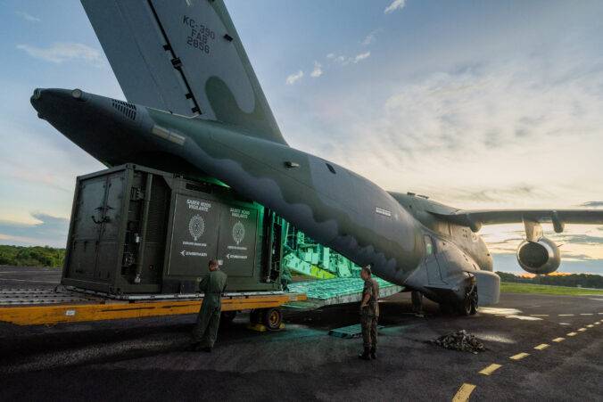
Parintins, Brazil, August 25th, 2023 – Embraer (NYSE: ERJ) and the Brazilian Army have successfully completed the first test of the M200 Vigilante radar, including the deployment of the equipment on the KC-390 aircraft from the Brazilian Air Force (FAB). The radar operation was carried out at Júlio Belém Airport, located in Parintins, during June and July. The Parintins City Hall, Júlio Belém Airport, and Viracopos International Airport also supported the initiative.

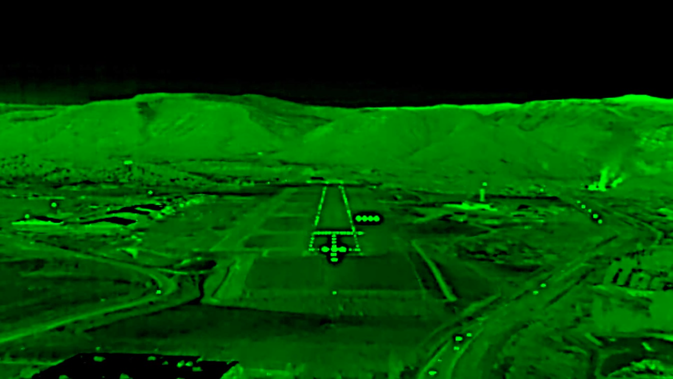
The location was chosen due to the Parintins Folkloric Festival, an event that causes a significant increase in air traffic in the region. Thousands of visitors accessed the city this year through Júlio Belém Airport, resulting in more than 800 landings and takeoffs in one week. The M200 Vigilante radar was transported for the first time on a KC-390, on a three-hour journey between Campinas, in São Paulo state, and the city located in the Amazon rainforest. The sensor continuously monitored air traffic within a 200 km range of the airport, working together with CINDACTA IV flight controllers. CINDACTA IV is the Brazilian Air Force agency responsible for flight monitoring in the northern region of the country.

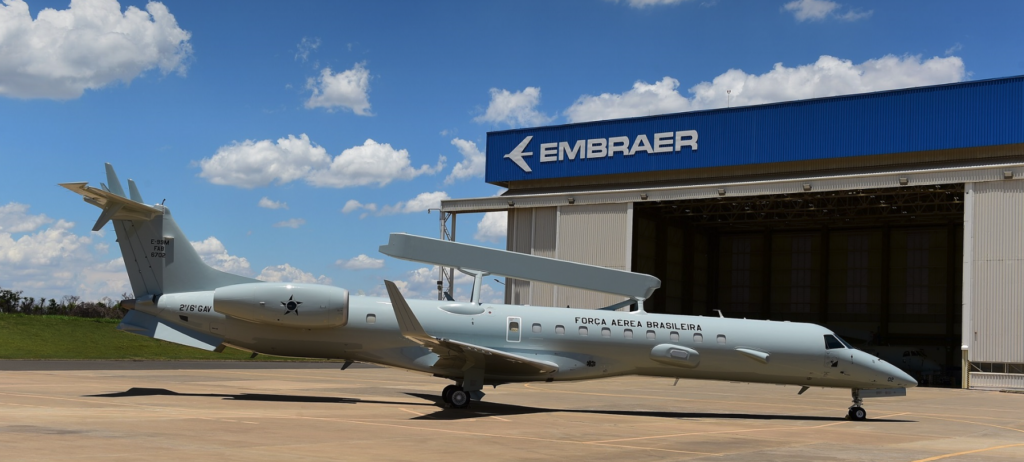
The M200 Vigilante radar is a medium-range sensor aimed at Air Surveillance and Early Warning applications. Using advanced processing techniques, it can identify and track positions and trajectories, as well as classify targets. It has an integrated power generation system, which guarantees operation autonomy for up to 48 hours and ease of transport by land and air platforms.

Collins Enhanced Vision Sensor Selected for Airbus Family of Aircraft

Collins Aerospace’s next-generation Enhanced Vision Sensor has been selected to be integrated into Airbus’ Enhanced Flight Vision System (EFVS). EFVS will become a selectable option on Airbus commercial aircraft, expanding approach capability and increasing flight situational awareness during reduced visibility conditions. The EFVS option, with the Collins EVS sensor, will be offered first on the A320 aircraft, with the intention to offer this solution on other platforms in the future.  

The EFVS will use input from the Collins Aerospace sensor, mounted on the nose of the aircraft, to create an augmented reality view of the outside world. The sensor uses multiple infrared and visible light cameras to “see through” poor visibility conditions better than the human eye. When the pilots view this camera video on head-up displays, it allows them to better identify the runway environment in all weather conditions — helping pilots overcome many flight disruptions often created by fog or precipitation. In addition, because the technology enables pilots to reduce delays on the runway and in the air, it actively reduces the amount of carbon emissions created by the aircraft. 

In addition, EFVS will also ease instrument to visual transition and provide enhanced situational awareness, in particular for “night Visual Meteorological Conditions (VMC)” conditions, and/or terrain, as well as lateral alignment on the runway, traffic and runway surface identification.

The next-generation EVS sensor will also be available for retrofit on existing in-service Airbus aircraft.

Embraer Delivers First Modernized E-99 Jet to Brazilian Air Force

From Embraer press release

In a ceremony held today at the Embraer facility in Gavião Peixoto (São Paulo, Brazil), Embraer delivered the first modernized EMB 145 AEW&C (Airborne Early Warning and Control), designated E-99, to the Brazilian Air Force (FAB). Four additional E-99 aircraft will be modernized as part of the contract.

The mission systems and related subsystems, including electronic warfare, command and control, electronic countermeasures, and aerial surveillance radar were updated as part of the modernization process, expanding FAB’s capacity to carry out Flight Control and Alarm missions and Electronic Reconnaissance, among others.

The E-99M project is conducted by COPAC with support from Embraer and various international suppliers, such as SAAB, Aeroelectronica International (AELI), and Rohde & Schwarz. In addition to modernization, the project entails technology transfer agreements that will enable technological advancements for the Brazilian defense industry.

Atech, an Embraer Defense and Security company, participates in the development of the command and control system. Six mission planning and analysis stations were also acquired, which will be used for the training and improvement of crews.

Built on the successful ERJ 145 regional jet platform, with more than 1,200 units delivered and 30 million flight hours, the FAB E-99 aircraft can detect, track, and identify targets in their patrol area and transmit this information to allied forces. The aircraft can also perform airspace management, fighter positioning and interception control, signals intelligence, and surveillance missions.

Airbus Announces New and Expanded Capability for OceanFinder

Toulouse, 18 September 2019 – Airbus Defence and Space has released the latest version of OceanFinder, its digital maritime service to detect, identify and track collaborative and non-collaborative vessels around the globe.

First launched in 2018, OceanFinder leverages Airbus’ advanced constellation of optical and radar satellites, combined with real-time global Automatic Identification System (AIS) data, and the latest in automated analytics, to support a broad range of critical applications across defence and security, shipping, oil and gas, and insurance markets.

OceanFinder’s latest updates introduce a number of innovative features – extending the service’s capabilities in several key areas. From today, users will benefit from enhanced imagery and AIS data correlation to identify the precise location of a non-responding vessel in near real-time. This development has been combined with the latest in fully-automated detection and classification, which utilises powerful proprietary algorithms to determine a vessel’s identity in just a few seconds. Subsequently, Airbus’ human analysts are able to focus on providing additional, value-added intelligence, such as interpretation of specific behaviour or threats, without delaying a report’s delivery. New tools have also been incorporated to provide the most relevant acquisition plan to predict routes and projected locations of vessels, based on last position, date, trajectory and speed. 

Several of the unique features have been made possible through a multi-year partnership with exactEarth, a leading provider of satellite-AIS data services. The agreement, which provides OceanFinder with access to exactView RT – exactEarth’s second-generation real-time satellite-AIS data platform – includes all live and archived data.

“By combining Airbus’ satellite imagery with the most advanced AIS data services and analytics, we are positioning OceanFinder as a key reference for maritime detection and identification” said François Lombard, Director of the Intelligence Business for Airbus Defence and Space. “Automation and near real-time are the two pillars through which we will provide our customers with the insights they need to make decisions faster, whether for real-time situational awareness, Search and Rescue operations or location and tracking of illegal maritime activities.”

OceanFinder is accessible through the OneAtlas web portal (oneatlas.airbus.com), enabling customers to ‘self-order’ the required products through a simple user interface that is available 24/7.