TOMORROWS TRANSPORTATION NEWS TODAY!

Tag: visual

Honeywell Technology For Drones Increases Range With Hydrogen Fuel Cells

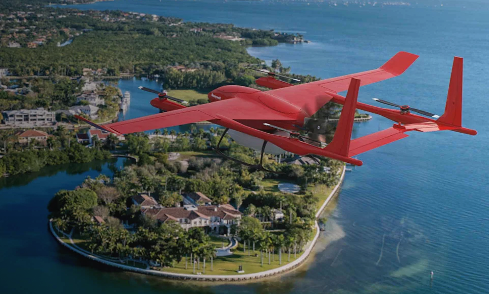
PHOENIX, Aug. 18, 2021 /PRNewswire/ — Honeywell (NASDAQ: HON) is developing a new technology suite for light drones that allows them to fly three times longer and with less human intervention. Compared with traditional drones using batteries and line-of-sight radio links, drones equipped with Honeywell’s Beyond Visual Line of Sight (BVLOS) technologies can fly farther, carry more weight, avoid hazards up to three kilometers away and stream video of their progress anywhere in the world.­

Honeywell’s BVLOS (pronounced bev-loss) systems are ideal for missions where distance or terrain interfere with radio links or visual guidance. Applications include last-mile package delivery, military intelligence, surveillance and reconnaissance, pipeline and power line inspection, search and rescue, or use by first responders.

The technologies draw upon Honeywell’s decades of experience building and certifying avionics, engines, and APUs for airplanes, helicopters and military drones.

The BVLOS suite comprises:

  • Honeywell’s 600-watt and 1200-watt hydrogen fuel cells
  • Honeywell’s RDR-84K multipurpose radar
  • Honeywell’s inertial measurement units (IMUs)
  • Honeywell’s UAV Satcom – the world’s smallest and lightest satellite transceiver

The fuel cells in the BVLOS suite operate three times longer than batteries with equivalent output. They work silently, unlike gasoline engines, and emit no greenhouse gases. Operators can refuel or swap hydrogen tanks in minutes, enabling more time in the air.

Honeywell’s RDR-84K is a phased-array radar that steers beams electronically, meaning it has no moving parts and requires minimal maintenance. It also requires no heavy cooling systems.

In addition to avoiding other aircraft, the radar can detect obstacles, map terrain and identify landing zones. It can act as a radar altimeter and provide mapping for alternate navigation if GPS guidance fails.

The BVLOS suite will allow drone designers to combine data in clever new ways to save weight and power. Its radar computes an avoidance path using built-in circuitry, rather than requiring a separate processor. Its satellite uplink can be used to download real-time weather and traffic reports from other drones.

Honeywell’s UAV Satcom and IMUs are available now, with some IMU models priced as low as $1,800. The RDR-84K and fuel cells are in late-stage development, and prototype fuel cells are available for purchase and evaluation now.

Hitachi Rail Successfully Tests First Battery-Powered Tram

  • Battery-powered tram offers major benefits of requiring no overhead wires or other electrified infrastructure – saving on costs and visual impact
  • On-board batteries allow energy to be additionally recovered during breaking
  • Trial in Florence aims to allow mobility firm to offer battery-trams globally
  • Tram adds to the growing list of battery products being developed as Hitachi puts decarbonisation and sustainability at the heart of its global strategy

Hitachi Rail has successfully tested its first battery-powered tram in Florence – an important milestone towards expanding the firm’s offer to market the vehicles across the world.

While traditional tram lines require electrified infrastructure  – usually overhead wires  supported by  poles or pylons – that are  expensive to install and visually unattractive. Battery trams offer the  opportunity to run high capacity public transport through city centres, while saving millions on installing wires and reducing the visual impact on beautiful historic streets, like Florence.

The trial involves installing battery packs on an existing Hitachi-built Sirio tram, which covered a section of the line under battery power. The innovation allows power to be returned to the batteries when the train breaks, reducing the overall amount of energy consumed and protecting the  environment.

This news is the latest in a number of announcements from the global mobility firm as expands its sustainability credentials and its zero-carbon offer to its customers around the world. Hitachi recently announced the trial of a battery train in the UK and delivery of hybrid trains in Italy, having built one of the world’s first battery powered train fleets that operates in Japan.

Hitachi has a rich heritage of building trams and tramways in Europe and in Asia, and is involved in new tram and metro infrastructure projects in the Americas and in the UK.

Andrea Pepi, Head of Sales and Projects Italy, Hitachi Rail said: “Our aim is to use our technology and our work to help build a sustainable society and contribute to the well-being of people around the world by improving their quality of life.”

“This is a key milestone as we pioneer this new technology that allow us to work with our customers to reduce infrastructure costs while still offering environmentally-friendly public transport. We hope  this successful trial in Italy creates new opportunities for us across the world.”

The Mayor of Florence, Dario Nardella said: “We are happy that Hitachi Rail has chosen the tramway in Florence to test this innovation. Battery-powered trams can revolutionize this type of service within cities. Public transport, especially in historic centers, will have to be less impactful and increasingly sustainable. This marks another significant step forward for the tramways in Florence.”

Garmin Announce Certification of G1000 NXi Upgrade in Piper Meridian

Garmin International Inc., a unit of Garmin Ltd. (NASDAQ: GRMN), today announced Federal Aviation Administration (FAA) certification and availability of the G1000 NXi upgrade for G1000-equipped Piper Meridian aircraft. The G1000 NXi integrated flight deck upgrade is available immediately for these aircraft through select Garmin dealers and features several new enhancements such as SurfaceWatch, visual approaches, geographical map overlay within the HSI and more.

This press release features multimedia. View the full release here: https://www.businesswire.com/news/home/20200819005056/en/

State-of-the-art processors support faster map rendering and smoother panning throughout the G1000 NXi displays. The flight displays also initialize in seconds so pilots have immediate access to frequencies, flight plan data and more, saving valuable time in the cockpit. The G1000 NXi integrated flight deck also incorporates contemporary animations and LED back-lighting, offering increased display brightness and clarity, reduced power consumption and improved dimming performance.

– The G1000 NXi integrated flight deck boasts a comprehensive feature set with new and advanced capabilities. Unique features included as part of the G1000 NXi upgrade for the Piper Meridian include:SurfaceWatch runway monitoring technology, which provides visual and aural cues to help prevent pilots from taking off or landing on a taxiway, on a runway that is too short or on the wrong runway based on performance data entered during preflight.

– Visual approaches offer pilots enhanced guidance in visual flight conditions based on a three-degree glideslope from the threshold of the runway. Pilots can set customized minimums, select vectors or straight-in for the final approach intercept and fly a visual approach coupled with the autopilot.

– Geographical map overlay within the HSI supports the display of NEXRAD, Flight Information Service-Broadcast (FIS-B) weather, weather radar, SafeTaxi airport diagrams, traffic1, terrain and more.

– Flight Stream 510 and Connext technology enables Database Concierge, the wireless transfer of aviation databases from the Garmin Pilot™ app on a mobile device to the G1000 NXi integrated flight deck. Flight Stream 510 also supports two-way flight plan transfer, the sharing of traffic, weather, GPS information and back-up attitude information.

– The G1000 NXi system supports the display of various Automatic Dependent Surveillance-Broadcast (ADS-B) In benefits via the GTX 345R transponder.

– Pilots can optionally overlay European Visual Reporting Points (VRPs) on the moving map, as VRPs are standard within the navigation database.

– Display of sectional charts, as well as IFR low/high enroute charts are available on the MFD.

– Smart Airspace highlights the airspace nearest the aircraft’s current altitude and de-emphasizes non-pertinent airspace.

– COM frequencies are decoded and displayed on the PFD for easier interpretation.

– Decoded Terminal Aerodrome Forecasts (TAFs) can be viewed on the MFD.

– Split-screen functionality allows pilots to view flight plans, charts and more simultaneously.

– An optional audio panel upgrade offers advanced features such as 3D Audio, auto squelch and Bluetooth connectivity.

The G1000 NXi integrated flight deck upgrade for existing G1000-equipped Piper Meridian aircraft is available immediately through select Garmin dealers. Meridian owners and operators can easily upgrade to the G1000 NXi with minimal aircraft down time and disruption of the panel as the displays preserve the same footprint and connectors, so panel modifications are not required. The upgraded components of the G1000 NXi also come with a two-year warranty, which is supported by Garmin’s award-winning avionics product support team.

Kobe Bryant Dies in California Helicopter Crash

The sports world was in mourning following news Sunday that Kobe Bryant, his daughter Gianna, and seven other people died died in a helicopter crash. Weather is believed to have been a contributing factor in the accident, as the conditions at the time were poor. The National Transportation Safety Board has sent a team of investigators to the site.

The helicopter reportedly departed John Wayne Airport in Orange County at 9:06 a.m. local time. The group was heading to the Mamba Sports Academy in Newbury Park. The Federal Aviation Administration reported that no flight plan had been filed. The Sikorsky S-76B helicopter was flying in low clouds and fog, and was operating under “special VFR” (special visual flight rules) status, requiring the pilot to be responsible for determining safe flying requirements in challenging weather conditions..

The helicopter crashed in foggy conditions on steep terrain in the mountains near Las Virgenes Road in Calabasas, California. The crash was reported to the Los Angeles County Fire Department. The crash set off a small brush fire in the area. Firefighters were able to contain the blaze, but were not able to find any survivors.

Kobe Bean Bryant, born 23 August 1978; died 26 January 2020

ATSB Australia Investigating Separation Incident at Albury Airport

The Australian Transport Safety Bureau (ATSB) says it is investigating a separation issue involving a Virgin Australia ATR 72-600 turboprop and Piper PA-28 light aircraft at Albury Airport.

The incident occurred on October 19 2019 when the Virgin Australia 72-600 VH-FVR was operating a regular public transport (RPT) flight from Sydney to Albury.

While passing through 1,300 ft and on a straight in approach to runway 25 at Albury Airport in visual meteorological conditions, the ATSB said the Virgin Australia turboprop received a traffic collision avoidance system alert on the PA-28.

The single-engine PA-28 VH-XDI, which was operated by the Australian Airline Pilot Academy, was turning final for Runway 25, the ATSB said in a short statement.

“The flight crew of the ATR 72 conducted a missed approach to increase separation between the two aircraft,” the ATSB said.

“As part of the investigation, the ATSB will interview directly involved parties and obtain other relevant information, including recorded data.”

The ATSB described the event as a near collision and a serious incident. There were no injuries.

Further, it said the investigation was expected to be completed by the second quarter of calendar 2020.

However, should a critical safety issue be identified during the course of the investigation, the ATSB said it would immediately notify relevant stakeholders in order that appropriate and timely safety action could be taken.

The Australian Airline Pilot Academy is a subsidiary of Regional Express (Rex), which recently bought another pilot training school based in Ballarat, ST Aerospace Academy.

Virgin Australia had eight ATR 72 turboprops in its fleet.

Saab and Vū Systems Launch Game-changing Enhanced Flight Vision System Solution

Saab and Vū Systems are launching a Next Generation Enhanced Flight Vision System (EFVS) solution using new passive millimetre wave (PMMW) technology, enabling pilots to see and land in low-visibility conditions at all times.

The Saab Vū EFVS enables commercial operators to maintain their schedule, while their competitors are forced to delay or cancel flights. It is the first system to provide reliable performance, unlocking access to airports in all weathers, without the need for conventional CATII/III infrastructure. The new Saab Vū EFVS provides the ability for take-off and landing in adverse weather conditions, including zero-visibility environments.

“The new system offers unmatched operational and safety advantages. Being able to take-off and land in low to zero-visibility environments radically reduces costs, increases safety and reduces environmental impact. This benefits pilots, operators and society as a whole. We are proud to be working together with Vū Systems to make this significant innovation commercially available,” says Jan Widerström, head of business unit Avionics Systems, within Saab business area IPS. 

Every year, commercial aviation all over the world incurs massive financial losses as a result of delays and cancellations due to low visibility weather. In the USA alone, these additional costs amount to billions of dollars.*   

To provide a solution to the impact of weather on U.S. flight operations, new FAA regulations (14 CFR 91.176) now permit landing without natural vision. The new regulations are performance based, meaning the performance of the EFVS sensor is critical to the operational value. The performance of the current EFVS sensors is limited by the atmospheric attenuation in the infrared band. 

The Saab Vū EFVS solution is not affected by weather, enabling pilots to achieve Equivalent Visual Operations (EVO) and see runways at distances of two miles and more in zero-visibility conditions.   

 “This strategic arrangement with Saab means we can supply this revolutionary technology through a qualified supply chain to larger commercial customers, benefiting the aviation industry globally, by enabling them to take off and land when their competitors cannot,” says Stedman Stevens, CEO at Vū Systems.

Through a strategic partnership with Vū Systems, who developed the first commercially available PMMW sensor, Vū Cube, the Saab Vū EFVS exceeds the new regulatory performance goals. This unique solution comprises a new, sophisticated PMMW sensor and software that optimizes the sensor images with IR and synthetic vision, projected on the new Saab Head-Up Display (HUD). It provides pilots with the complete solution and the means necessary to land safely regardless of thick fog, snow, rain, smog, dust, smoke and clouds.

Garmin Adds G1000 NXi Upgrade for the King Air C90

OLATHE, Kan.–(BUSINESS WIRE)– Garmin International, Inc., a unit of Garmin Ltd. (NASDAQ: GRMN), today announced certification of the G1000® NXi integrated flight deck upgrade for the King Air C90. With the G1000 NXi, aircraft owners and operators receive a wealth of new features, innovative capabilities and added utility all within a modern flight deck. King Air C90 owners and operators can easily upgrade from the G1000 to the G1000 NXi with minimal aircraft downtime and installation labor to receive a next-generation integrated flight deck.“As the popularity and demand of the G1000 NXi continues to grow, we’re excited to expand the availability of this upgrade to even more aircraft”

“As the popularity and demand of the G1000 NXi continues to grow, we’re excited to expand the availability of this upgrade to even more aircraft,” said Carl Wolf, vice president of aviation sales and marketing. “The G1000 NXi is an advanced flight deck that adds modern features including wireless connectivity, visual approach guidance, SurfaceWatch™, HSI map and more, all of which add tremendous value and advanced capability than ever before into existing King Air C90 aircraft.”

Flight Stream 510 and Connext® technology within the G1000 NXi integrated flight deck enables Database Concierge, the wireless transfer of aviation databases from the Garmin Pilot™ app on a mobile device to the G1000 NXi. Additional features include two-way flight plan transfer, the sharing of traffic1, weather1, GPS information, back-up attitude information and more, between the G1000 NXi and the Garmin Pilot, FltPlan Go and ForeFlight Mobile applications.

Visual approach guidance and map overlay within the horizontal situation indicator (HSI) further enhance the G1000 NXi feature set. Within the HSI map, pilots can overlay NEXRAD, Flight Information Service-Broadcast (FIS-B) weather, weather radar, SafeTaxi® airport diagrams, traffic, terrain and more. NEXRAD weather radar imagery can be overlaid on the moving map and animated on the multifunction display (MFD). Split-screen view is also available on the MFD, offering a simultaneous view of maps, charts, checklists, flight plans and more on a single screen. The addition of sectional charts and IFR low/high enroute charts give pilots convenient access to chart data on the flight display.

The G1000 NXi also supports the display of Automatic Dependent Surveillance-Broadcast (ADS-B) In traffic and subscription-free Flight Information Service-Broadcast (FIS-B) weather. The addition of SurfaceWatch runway monitoring technology provides visual and aural cues to help prevent pilots from taking off or landing on a taxiway, on a runway that is too short or on the wrong runway based on performance data entered during preflight. Visual and audible runway distance remaining annunciations are also available via SurfaceWatch within the G1000 NXi.

Modernized displays offer improved readability, while state-of-the-art processors provide smoother panning throughout the displays and faster map rendering within the G1000 NXi. Because the flight displays initialize in seconds, pilots have immediate access to frequencies, flight plan data and more, saving valuable time in the cockpit. The G1000 NXi integrated flight deck also incorporates contemporary animations and new LED back-lighting, offering increased display brightness and clarity, reduced power consumption, and improved dimming performance.

This upgrade adds to the growing portfolio of aircraft eligible for the G1000 NXi integrated flight deck upgrade, including the King Air 200/300/350, Daher TBM 850/900, Cessna Citation Mustang, the Piper PA-46 and soon, the Embraer Phenom 100. Aircraft owners and operators can easily upgrade to the G1000 NXi with little aircraft down time and disruption of the panel because the displays preserve the same footprint and connectors, so panel and wiring modifications are minimized. The G1000 NXi upgrade for the King Air C90 is available immediately through select Garmin dealers. The upgraded components of the G1000 NXi also come with a two-year warranty, which is supported by Garmin’s award-winning avionics product support team. For additional information regarding the G1000 NXi upgrade for the King Air, contact Scott Frye at 913-440-2412 or scott.frye@garmin.com.

Garmin’s aviation business segment is a leading provider of solutions to OEM, aftermarket, military and government customers. Garmin’s portfolio includes navigation, communication, flight control, hazard avoidance, an expansive suite of ADS-B solutions and other products and services that are known for innovation, reliability, and value. For more information about Garmin’s full line of avionics, go to www.garmin.com/aviation.